Outer Banks NC Traffic & Road Conditions
Live cameras, road conditions, accident reports, and construction alerts for Dare County
How Dare County Moves: Highways, Commutes & Freight
A driver's-eye reference to the interstates, US highways, commute corridors, and freight infrastructure that define how Outer Banks gets where it's going.
Major Highways in Dare County
Dare County sits at the convergence of US-158 (Croatan Highway), US-64/264 (Marc Basnight Bridge / Virginia Dare Memorial Bridge), NC-12 (NC Outer Banks Highway), NC-345, and US-17 (mainland connector via Elizabeth City). Together these routes carry essentially every commercial truck, commuter car, and out-of-state visitor that touches Outer Banks in a given day — which is why a single closure or rolling backup on any one of them ripples across the rest within minutes.
-
US-158 (Croatan Highway)Primary commercial corridor through northern OBX; main entry route from mainland via Wright Memorial Bridge.
-
US-64/264 (Marc Basnight Bridge / Virginia Dare Memorial Bridge)Primary access route to Roanoke Island and Manteo county seat; two parallel bridges over Croatan Sound.
-
NC-12 (NC Outer Banks Highway)Single north-south spine through all barrier island communities from Corolla to Hatteras Village; frequently closed by storm damage.
-
NC-345North-south connector on Roanoke Island to US-64/264 and US-158.
-
US-17 (mainland connector via Elizabeth City)Mainland access route from northern OBX via Currituck to Hampton Roads.
Commute Patterns & Regional Drives
Outer Banks commuters operate on a regional grid, not a city grid. Here is how long the most-driven trips actually take from Outer Banks:
The volume comes with a cost. Dare County recorded 8 traffic fatalities in 2023 — roughly 21.3 per 100,000 residents, per the NC Department of Public Safety fact book.
Freight, Inland Port & Airport Traffic
Add Dare County Regional Airport (MEO) to the picture. It is the region's primary commercial airport, and the drive in from Outer Banks is a short hop.
Transit fills a smaller share of the picture. Dare Transportation runs the city's fixed-route bus and microtransit service; basic fare is 1.
All figures sourced from state DOT traffic counts, the state Department of Public Safety fact book, the regional ports authority, and the local airport district — refreshed as new annual reports drop. Live conditions, accidents, and lane closures are above; this section explains the system those incidents move through.
{{DOT}} Traffic Cameras — Dare County
Camera thumbnails link directly to — no {{DOT}} API key required.
Real-Time Resources
- SC DOT official traffic info portal
- {{DOT}} Road Conditions Statewide conditions & alerts
- Dare County Road Department County roads, bridges & maintenance
- {{STATE_HP}} Incident Reports SC Highway Patrol incident log
- Dial 911 Emergency — police, fire, EMS
- *HP (*47) {{STATE_HP}} Non-Emergency — highway patrol
- (864) 596-2038 Outer Banks PD Traffic Unit
- GSP Airport Traffic Outer Banks International Airport
- Waze Outer Banks Live Map Crowd-sourced real-time traffic routing
Outer Banks Traffic News
Outer Banks Accidents & Crash Reports
Stay informed about crashes, closures, and road safety in Dare County.
Outer Banks DUI Reports & Checkpoints
DUI enforcement updates, checkpoint alerts, and impaired driving data for Dare County
Dare County DUI Data
- 1,127 monitored DUI cases in Dare County (MADD Court Monitoring, 2019–2024)
- 65% conviction rate — the highest of all 7 monitored SC counties
- SC is #5 nationally for drunk driving fatalities — 474 deaths in 2022
- BAC limit: 0.08% for drivers 21+, 0.02% for under 21
- First offense penalties: $400–$1,000 fine, 48 hours–90 days jail, 6-month license suspension
- Refusing a breathalyzer results in automatic 6-month license suspension under SC implied consent law
Outer Banks School Traffic & Zone Safety
School zone speed limits, pickup/dropoff schedules, bus route alerts, and safety tips for Dare County parents and commuters
School Zone Speed Limits
North Carolina law requires drivers to reduce speed to the posted school zone limit during designated hours. Fines are doubled in active school zones. Watch for flashing beacon signals near all Outer Banks schools.
Pickup & Dropoff Hours
Peak school traffic: 6:30–8:30 AM and 2:00–4:00 PM on school days. Allow extra commute time during these hours. Obey no parking and no stopping signs near school entrances.
School Bus Safety
SC law requires all vehicles to stop for school buses with extended stop signs and flashing red lights. Passing a stopped school bus carries fines up to $1,000 and potential license suspension. Children should wait in a safe place away from traffic.
Back-to-School Alerts
Each August, traffic patterns shift across Dare County as 9 school districts resume classes. Watch for new traffic patterns, construction near schools, and increased pedestrian activity at intersections.
Outer Banks Commute Facts
Key statistics for Dare County commuters
Active Construction & Closures
Major construction and road closure alerts will be posted here as they are reported. Our team monitors {{DOT}} and county notices daily to keep Dare County commuters informed.
For real-time closure information, visit — the official {{DOT}} traffic portal for North Carolina.
View Closures on {{TRAFFIC_511_NAME}} →
Legal help when it matters — for Outer Banks drivers
Ticket questions, accident questions, ask-a-lawyer access, and DIY legal documents from Rocket Lawyer — trusted by millions of Americans.
Get Legal Help Now →Sample placement shown. Rocket Lawyer link is an affiliate partner of News Outer Banks; we may earn a commission at no cost to you.
Latest Outer Banks Traffic News
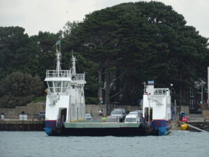
Outer Banks, N.C.: Board seeks delay on ferry tolls
OUTER BANKS, N.C. — For Outer Banks travelers, the N.C. Board of Transportation on Thursday asked the General Assembly to delay new statewide ferry tolls until at least…
Outer Banks, N.C.: NC-12 fully reopens at Pea Island
OUTER BANKS, N.C. — On the Outer Banks, N.C. Highway 12 is now fully reopened near the Pea Island Visitor Center after NCDOT crews finished rebuilding protective sand…