News Summary
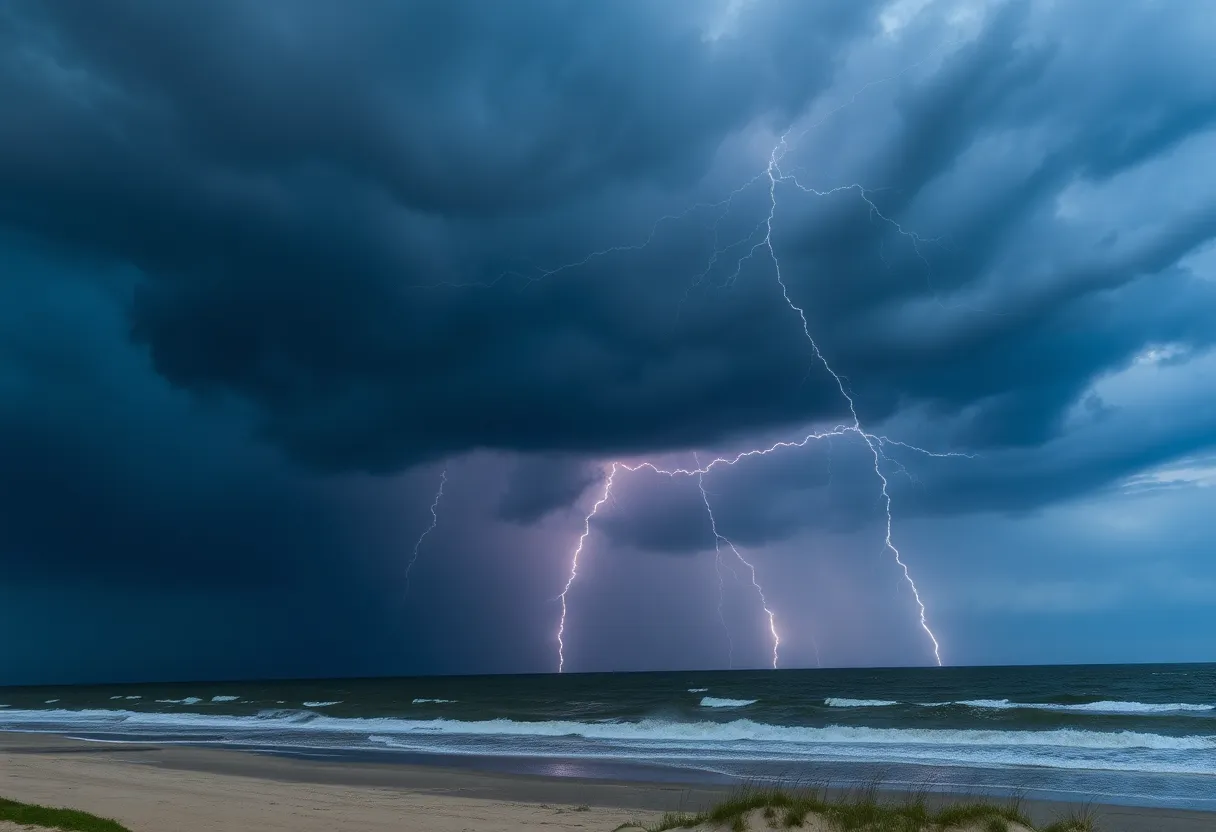
The National Weather Service has issued a severe thunderstorm alert for the Northern Outer Banks, warning residents of wind gusts up to 40 mph and frequent lightning. A significant storm over Roanoke Island is moving southeast, prompting safety precautions. Affected areas include Nags Head, Manteo, and Jockeys Ridge State Park. Residents are advised to seek shelter and stay informed due to potential severe storms and flooding forecasted for the region.
Severe Thunderstorm Alert Issued for Northern Outer Banks, North Carolina
Kill Devil Hills, N.C. – The National Weather Service (NWS) Newport/Morehead City NC has issued a severe thunderstorm alert for the Northern Outer Banks, effective until 4 p.m. today. Residents are advised to prepare for adverse weather conditions, including wind gusts reaching up to 40 mph and frequent lightning activity.
As of 3:31 p.m., Doppler radar detected a significant thunderstorm located over Roanoke Island Festival Park, about 7 miles south of Kill Devil Hills. This storm is currently moving southeast at a speed of 10 mph. The hazardous winds from this storm pose risks such as uprooted tree limbs and airborne debris, which could pose a threat to outdoor safety.
The severe thunderstorm alert affects various areas, including:
- Nags Head
- Manteo
- Whalebone
- Jockeys Ridge State Park
- Roanoke Island Festival Park
- Wanchese
- Wright Brothers National Monument
- Nags Head Fishing Pier
- Bodie Island Lighthouse
- Outer Banks Fishing Pier
Residents in the affected areas are recommended to seek shelter indoors or within vehicles if they find themselves outdoors. The risk of lightning escalates as the thunderstorm approaches, reaching its peak intensity while the storm is overhead, and subsiding as it moves away from the area.
Nationwide statistics indicate that lightning strikes the United States approximately 25 million times annually, leading to around 20 fatalities each year. Due to the high frequency of lightning during thunderstorms, taking precautions to reduce exposure is essential.
Weather Forecast and Safety Recommendations
This alert is part of a broader weather forecast predicting potential severe storms and tornadoes in coastal North Carolina this Monday, with the possibility of flooding in some areas. Additionally, Coastal Carolina is currently under a level 2 out of 5 threat for severe storms, while the remainder of North Carolina is under a level 1 threat.
Residents are urged to remain vigilant for damaging winds associated with this storm, which may result in dangerous conditions. It is also important for drivers to be aware of the risks related to hydroplaning. Hydroplaning occurs when a vehicle slides uncontrollably on wet roads due to water buildup in front of the tires. This situation arises when vehicles are unable to displace the water adequately, which can be exacerbated by a vehicle’s weight and the amount of standing water on the roadway.
In addition to the severe thunderstorm threats, a potential tropical system known as Tropical Potential Cyclone Eight is making its way toward the South Carolina coast, packing maximum sustained winds near 50 mph. This system is expected to impact the Carolinas from Monday night through Wednesday, bringing additional weather concerns that could include further severe storms and flooding in the region.
Residents are encouraged to stay informed about weather alerts and to follow any guidance provided by local authorities. Preparation and awareness are key to ensuring safety during these developing weather conditions.
Deeper Dive: News & Info About This Topic
HERE Resources
Severe Weather Hits Coastal North Carolina
Discover the Charm of Carolina Beach, NC
Severe Thunderstorm Warning Issued for Outer Banks
Cape Hatteras National Seashore Promotes Beach Safety
NWS Issues Beach Hazards Statement for Outer Banks
Life-Threatening Rip Currents Warnings for Outer Banks
Severe Thunderstorm Warning for Northern Outer Banks
Severe Thunderstorm Alert for Northern Outer Banks
Severe Thunderstorm Warning Issues for Northern Outer Banks
Recent Surge in Seaside Tourism and Recreation Employment in the U.S.
Additional Resources
- CBS 17 News
- Wikipedia: North Carolina
- News Observer
- Google Search: North Carolina weather
- WTKR News
- Google Scholar: North Carolina severe thunderstorms
- Charlotte Observer
- Encyclopedia Britannica: North Carolina weather
- Pilot Online
- Google News: North Carolina thunderstorm alerts


