News Summary
The National Weather Service has issued a severe thunderstorm alert for the Northern Outer Banks of North Carolina, expected to last until 8:45 p.m. Residents in areas such as Sanderling and Duck Coe Pier should be cautious as hazards include marble-sized hail and wind gusts up to 50 mph. A Severe Thunderstorm Watch remains in effect for eastern North Carolina until midnight. Residents are advised to seek shelter indoors during this period.
Severe Thunderstorm Alert for Northern Outer Banks, North Carolina
The National Weather Service (NWS) Newport/Morehead City, NC, has issued a severe thunderstorm alert for the Northern Outer Banks, effective until 8:45 p.m. on Thursday. The regions specifically affected by these strong thunderstorms include Sanderling and Duck Coe Pier.
Residents in these areas should be aware that potential hazards associated with the storms include marble-sized hail measuring approximately 0.5 inches in diameter and wind gusts that could reach up to 50 mph. Doppler radar has reported a powerful thunderstorm located near Grandy, progressing eastward at a speed of 30 mph.
The possible impacts of these storms are significant. Gusty winds could lead to downed tree limbs and the movement of unsecured items, posing a danger to outdoor activities. Additionally, minor damage to vegetation due to hail is anticipated. The NWS strongly advises individuals outdoors to seek shelter inside a building to ensure their safety.
A Severe Thunderstorm Watch remains in place until midnight for eastern North Carolina, indicating that conditions are favorable for severe thunderstorms to develop in the area. Residents should remain vigilant during this watch period as storms can escalate quickly.
Safety Measures and Risks
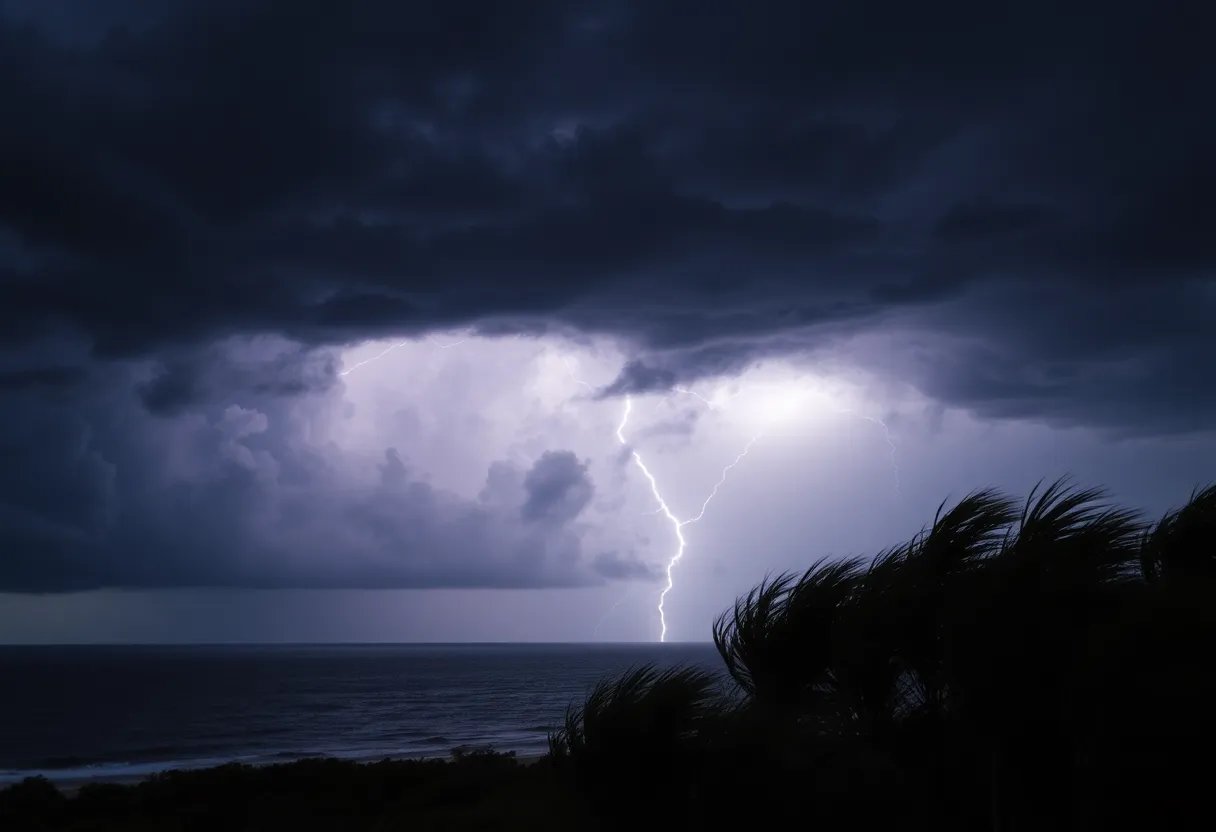
During thunderstorms, the risk of lightning increases significantly, particularly as the storm approaches its peak. Lightning strikes approximately 25 million times across the United States each year, with summer months being the most active. On average, these strikes result in around 20 fatalities annually. It is crucial for individuals to stay indoors when a thunderstorm is imminent and to avoid areas where the risk of lightning is highest.
Another potential hazard during severe weather is hydroplaning, which occurs when a vehicle slides uncontrollably on wet roads. This phenomenon is caused by water accumulating in front of tires faster than the vehicle can displace it. Key factors influencing hydroplaning include vehicle speed, tire tread depth, and the depth of water on the roadway. Drivers are advised to reduce their speed and maintain a safe distance from other vehicles when conditions are wet to avoid accidents.
Understanding Thunderstorm Dynamics
As thunderstorms develop, the likelihood of lightning is at its highest when the storm is directly overhead. This risk diminishes as the storm moves away from an area. Awareness of this pattern can enhance safety during severe weather events, reminding all individuals to be cautious and prepared for sudden changes in weather conditions.
In conclusion, the NWS is closely monitoring the situation for the Northern Outer Banks and urges residents to take the necessary precautions during the severe thunderstorm alert. Seeking shelter, heeding safety guidelines, and being aware of potential risks such as hail and wind damage are critical for staying safe during this weather event.
Deeper Dive: News & Info About This Topic
HERE Resources
Southeast Faces Major Flooding Threat as Atmospheric River Hits
Severe Weather Alert: Tornado Risks Extend Across Upper Midwest
Central US Faces Severe Weather and Flooding Risks
Severe Tornado Outbreak Causes Widespread Destruction Across U.S.
Severe Flooding Strikes Coastal North Carolina
Devastating Tornadoes Cause Tragedy and Destruction Across Six States
Massive Storm System Threatens Over 100 Million Americans
Severe Weather Alert: A Weekend of Storms Ahead!
Storm Delivers a Wild Ride Across Southern California
Winter Weather Alert: Two Major Storms Expected
Additional Resources
- CBS17: Outer Banks Expecting Snowfall
- Wikipedia: Thunderstorm
- Pilot Online: Landspout Tornado in Kill Devil Hills
- Google Search: Thunderstorm Safety
- ABC11: First Alert Weather Forecast
- Encyclopedia Britannica: Thunderstorm
- Herald Sun: Weather News
- Google News: Severe Weather Alerts


