Outer Banks, North Carolina, September 9, 2025
News Summary
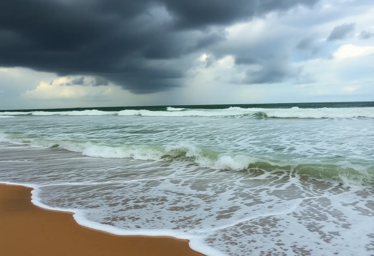
The National Weather Service has warned of dangerous rip currents and large waves in North Carolina’s Northern Outer Banks due to Hurricane Erin, a Category 2 storm. A beach hazards statement is in effect, urging swimmers to exercise caution. Emergency responders conducted numerous rescues recently, highlighting the risks associated with potentially strong rip currents. Local states of emergency have been declared, and evacuations are in place for Hatteras and Ocracoke islands as significant coastal flooding is anticipated.
Outer Banks, North Carolina Faces High Rip Current Risk as Hurricane Erin Approaches
The National Weather Service (NWS) has issued an updated beach hazards statement for North Carolina’s Northern Outer Banks, effective from 8 p.m. Monday until 8 p.m. Tuesday. A potent combination of dangerous rip currents and large breaking waves are expected in the surf zone as Hurricane Erin, a Category 2 storm, approaches the region.
Rip currents pose a significant threat to swimmers, risking even the most experienced beachgoers. The highest likelihood of strong rip currents is anticipated a couple of hours before and after low tide, which occurs around 3 p.m. on Tuesday. Beach-goers are strongly advised to swim only near lifeguard stations and to avoid venturing too far into the water to minimize these risks.
On Monday, emergency responders performed approximately 90 rip current rescues across North Carolina, with at least 75 of these rescues taking place along New Hanover County’s southern coast. As a result, a no-swim advisory has been issued through Friday for that area. Dangerous shore breaks can lead to neck and back injuries as swimmers can be thrown headfirst into the seabed.
The NWS has reported that the risk level for rip currents will be high from Duck to Hatteras, moderate from Ocracoke to Cape Lookout, and lowest along the Crystal Coast. To ensure safety, local officials have outlined essential guidelines for swimmers, including remaining calm if caught in a rip current, swimming parallel to the shore, floating or treading water when fatigued, and signaling for help if further assistance is needed.
Impact of Hurricane Erin
Hurricane Erin, while currently not expected to make landfall, is projected to create hazardous conditions along the East Coast, including rough surf and dangerous currents. A tropical storm warning is in effect for the coast from central North Carolina to Duck, and a tropical storm watch has been issued for the northern Outer Banks up to Cape Charles Light in Virginia.
Dare and Hyde counties have declared local states of emergency, prompting mandatory evacuations for Hatteras and Ocracoke islands. Significant coastal flooding is anticipated due to storm surge, potentially rendering Highway 12 impassable for several days. Erin’s winds are expected to generate storm surges of up to 4 feet along the Outer Banks late Wednesday into Thursday.
Beach Erosion and Additional Risks
The NWS warns of extensive beach erosion, with waves projected to exceed 20 feet in height. The highest tides of the month are expected on Wednesday and Thursday, which could exacerbate coastal flooding conditions. Furthermore, similar rough seas and tropical storm-force winds are expected to affect Bermuda later this week as well.
As the Atlantic hurricane season remains active, additional areas are under observation for potential tropical development. Residents and visitors on the Outer Banks are urged to stay informed and prepared as conditions continue to evolve in relation to Hurricane Erin.
FAQ Section
What is the current status of Hurricane Erin?
Hurricane Erin is a Category 2 storm currently approaching the East Coast, impacting North Carolina’s Outer Banks with rough surf and dangerous currents.
What are the safety recommendations for swimming in the Outer Banks during this time?
Swimmers should stay near lifeguard stations, avoid venturing too far into the water, and follow guidelines for managing rip currents, including swimming parallel to the shore and signaling for help if caught.
What areas are under high risk for rip currents?
The highest rip current risk is from Duck to Hatteras, with moderate risk from Ocracoke to Cape Lookout and the lowest risk along the Crystal Coast.
What local emergency measures are in effect due to Hurricane Erin?
Dare and Hyde counties have issued local states of emergency and mandated evacuations for Hatteras and Ocracoke islands.
How many rescues have been made due to rip currents recently?
Approximately 90 rip current rescues were performed across North Carolina on Monday, with a significant number occurring on New Hanover County’s southern coast.
Deeper Dive: News & Info About This Topic
HERE Resources
North Carolina Coast Road Reopens After Severe Flooding
Ocracoke, North Carolina Faces Aftermath of Hurricane Erin
Hurricane Erin Triggers Evacuations and Flood Warnings in Nags Head
Newport, North Carolina Faces Life-Threatening Rip Currents
Hurricane Erin Approaches Outer Banks, NC: Tropical Storm Watch in Effect
North Carolina’s Outer Banks Devastated by Hurricane Erin
Discover North Carolina’s Charming Small Towns for Travelers
Tragic Drowning Incident in Nags Head, North Carolina
Hurricane Erin Triggers Life-Threatening Coastal Conditions in North Carolina
Hurricane Erin Triggers High-Risk Conditions Along North Carolina’s Outer Banks
Additional Resources
- News Observer
- Wikipedia: Rip Current
- WITN
- Google Search: Hurricane Erin
- 13 News Now
- Encyclopedia Britannica: Hurricane
- WXII12
- Google News: Outer Banks Weather
- ABC7 NY
- Google Scholar: Hurricane Erin Rip Currents
- Herald Sun


