Northern Outer Banks, NC, September 17, 2025
News Summary
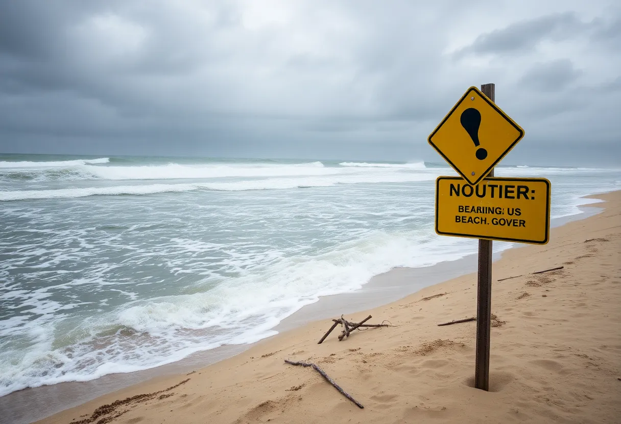
The National Weather Service has issued an updated advisory for the Northern Outer Banks and Hatteras Island, warning of life-threatening rip currents and potential coastal flooding. Effective from Tuesday evening until Wednesday evening, the advisory highlights high risk along the shoreline, particularly from Duck to Hatteras. Residents and visitors are urged to exercise caution in all beach activities and be aware of shallow flooding impacts in low-lying areas.
Northern Outer Banks, NC: Updated Beach Hazards and Coastal Flood Advisory Issued
The National Weather Service (NWS) Newport/Morehead City NC issued an updated beach hazards statement on Tuesday evening, cautioning residents and visitors of the Northern Outer Banks and Hatteras Island about potential dangers from rip currents and coastal flooding. The advisory is effective from 8 p.m. Tuesday until 8 p.m. Wednesday and is anticipated to pose serious risks to those venturing into the water.
The NWS warns that life-threatening rip currents are expected, with particularly high risks highlighted from Duck to Hatteras. These strong currents can quickly pull even experienced swimmers into deeper waters, heightening the danger for beachgoers. The advisory emphasizes the importance of remaining calm if caught in a rip current, recommending that individuals swim parallel to the shore rather than directly back to land and call for help if they find themselves unable to escape.
In contrast, the Crystal Coast is reported to experience the lowest risk for dangerous rip currents, providing a slightly safer option compared to other locations along the coast. However, visitors are urged to exercise caution at all beaches, ensuring that lifeguards are present and avoiding areas that may be too deep for safety.
Alongside the beach hazards statement, a coastal flood advisory was released at 3:12 p.m. valid until 8 p.m. This advisory particularly affects low-lying areas near shorelines and tidal waterways in the Northern Outer Banks. It is estimated that there could be up to one foot of inundation above ground level, which could lead to shallow flooding in roads, parking lots, parks, and residential properties adjacent to the waterfront.
The NWS suggests that the low threat of property damage could still impact everyday activities, with localized beach erosion and dangerous swimming and surfing conditions expected. Travelers are advised to plan accordingly, allowing extra time on their journeys as certain roads may be closed due to flooding. It is crucial not to drive around barricades or through any water of unknown depth, as this could lead to hazardous situations.
Property owners in flood-prone areas are encouraged to take measures to protect their property by seeking higher ground and adhering to any evacuation orders issued. It is imperative to remain vigilant against the dangers of floodwaters, avoid submerged electrical outlets or cords, and be aware that just six inches of moving water can knock an adult off their feet. Additionally, hydroplaning may occur when vehicles encounter standing water, leading to a loss of control. Drivers are particularly cautioned to avoid driving through flooded areas, as vehicles can be swept away by as little as 12 inches of rushing water.
Key Safety Precautions
- Remain calm if caught in a rip current and swim parallel to shore.
- Check for the presence of lifeguards before entering the water.
- Be mindful of shallow flooding and road closures from coastal flooding.
- Do not drive through flooded areas and avoid water of unknown depth.
- Monitor local weather updates for any changes in conditions.
Conclusion
As conditions remain potentially hazardous, beachgoers and residents of Northern Outer Banks and Hatteras Island are encouraged to stay informed and exercise caution over the coming days. Preparation and awareness of the dangers associated with rip currents and coastal flooding will be crucial for safety during this period.
FAQ
What is the duration of the beach hazards statement?
The beach hazards statement is in effect from 8 p.m. Tuesday until 8 p.m. Wednesday.
The beach hazards statement is in effect from 8 p.m. Tuesday until 8 p.m. Wednesday.
What areas are affected by the coastal flood advisory?
The advisory affects low-lying areas in the Northern Outer Banks, particularly near shorelines and tidal waterways.
The advisory affects low-lying areas in the Northern Outer Banks, particularly near shorelines and tidal waterways.
What should individuals do if caught in a rip current?
Individuals should remain calm, swim parallel to shore to break free from the current, and call for help if necessary.
Individuals should remain calm, swim parallel to shore to break free from the current, and call for help if necessary.
What preparations should property owners take for potential flooding?
Flood-prone property owners should seek higher ground, follow local evacuation instructions, and take measures to protect their property.
Flood-prone property owners should seek higher ground, follow local evacuation instructions, and take measures to protect their property.
Key Features Chart
| Feature | Description |
|---|---|
| Advisory Duration | 8 p.m. Tuesday to 8 p.m. Wednesday |
| Rip Current Risks | High risk from Duck to Hatteras |
| Flood Inundation Estimates | Up to 1 foot above ground level |
| Driving Precautions | Avoid flooded areas; just 12 inches can sweep away vehicles |
| Swimming Safety | Use caution, verify lifeguard presence |
Deeper Dive: News & Info About This Topic
HERE Resources
Ocracoke Island Road Closure Due to Severe Weather
Oceanfront Home in Buxton Collapses into Atlantic Ocean
Tropical Disturbance May Develop into Depression This Week
Modular Home Blown Off Trailer in Outer Banks Incident
Coastal Storm Threatens Mid-Atlantic with Heavy Rain and Winds
NCDOT Announces Speed Limit Changes Along N.C. 12
North Carolina’s Outer Banks Brace for Hurricane Erin
Coastal Flood Advisory Issued for Northern Outer Banks and Hatteras Island as Hurricane Erin Approaches
NCDOT Updates Speed Limits on Highway 12 in the Outer Banks
Two Teenagers Charged in Fatal Avalon Pier Shooting
Additional Resources
- News Observer: Updated Beach Hazards and Coastal Flood Advisory
- Wikipedia: Rip Current
- WITN: Rip Current Risk Staying High
- Google Search: Coastal Flooding Hazards
- Charlotte Observer: Beach Weather Update
- Encyclopedia Britannica: Weather
- 13 News Now: Labor Day Weather Update
- Google News: Rip Current Safety Tips


