Outer Banks, North Carolina, September 10, 2025
News Summary
North Carolina’s Outer Banks are under threat from Hurricane Erin, a Category 2 storm prompting mandatory evacuations in Ocracoke and Hatteras Islands. Governor Josh Stein declared a state of emergency as the storm approaches with dangerous storm surges and winds expected. Residents are warned to prepare for severe coastal conditions and to avoid the ocean due to rip currents and hazardous surf.
North Carolina’s Outer Banks Brace for Hurricane Erin: Evacuations and Storm Surge Alerts in Effect
North Carolina’s Outer Banks are currently facing significant threats from Hurricane Erin, now categorized as a Category 2 hurricane. The storm is expected to bring life-threatening conditions, including a predicted storm surge and high winds that have led to mandatory evacuations in several areas, including Ocracoke Island and Hatteras Island.
In response to the impending crisis, North Carolina Governor Josh Stein has declared a state of emergency to facilitate disaster response and mobilization of resources. The tropical storm conditions are forecasted to hit the Outer Banks by late Wednesday, with accompanying storm surge and coastal flooding warnings already in place.
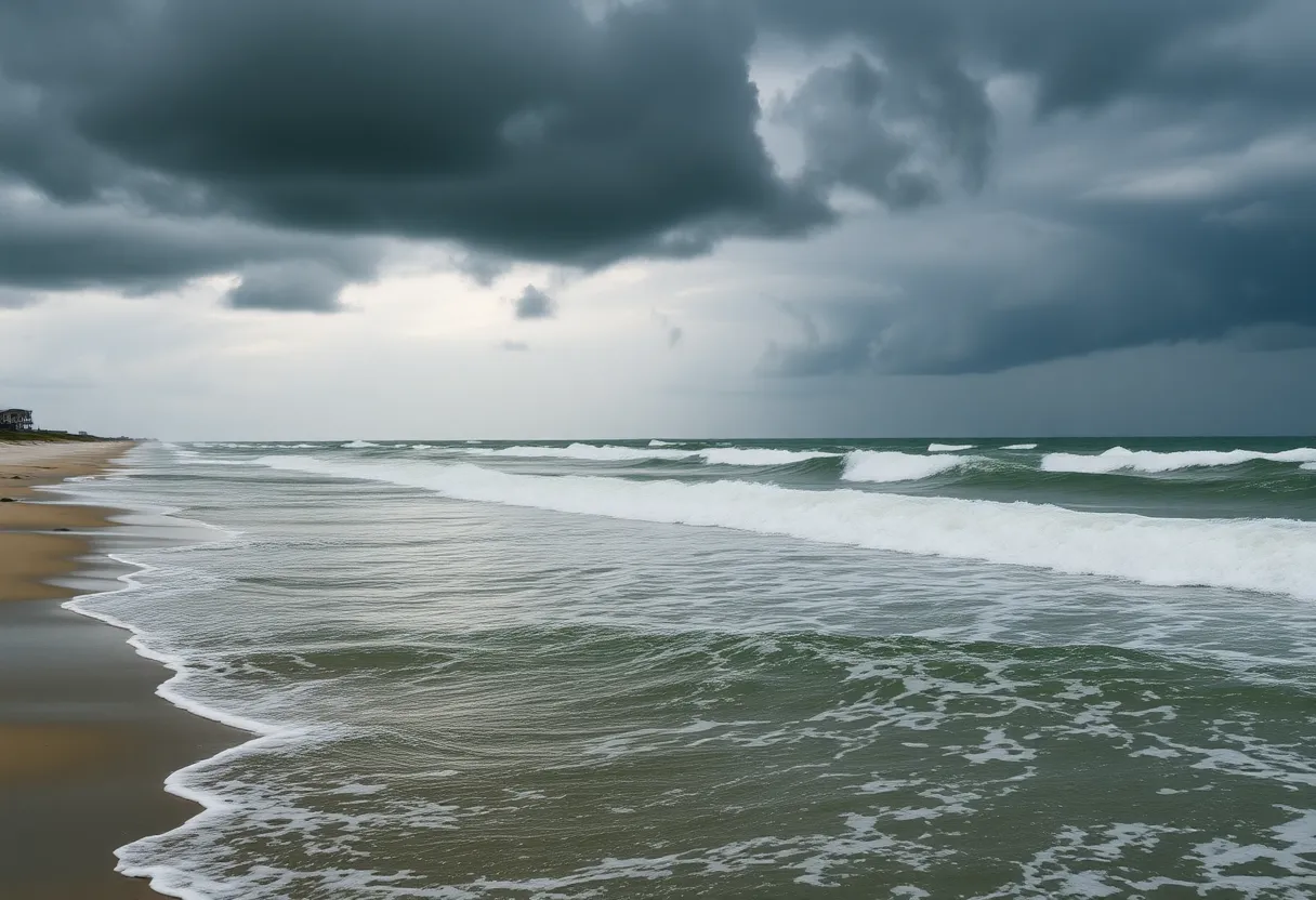
The National Weather Service has projected that the storm surge could elevate water levels by 2 to 4 feet above ground level along the oceanfront, posing severe risks to both life and property. A High Surf Advisory and Coastal Flood Watch have been issued, particularly affecting the Northern Outer Banks, Carteret County, and Ocracoke Island.
Potential Impacts and Evacuations
Major beach erosion and overwash are anticipated, with waves potentially reaching 15 to 20 feet. In addition to the storm surge, wind speeds could reach up to 60 mph, exacerbating hazardous ocean conditions. Local officials have already initiated water rescue operations, with numerous rescues reported at Wrightsville Beach due to dangerous surf and rip currents.
Highway 12 on Hatteras Island is expected to become impassable due to coastal flooding and overwash, while minor flooding has already been observed on Ocracoke Island in advance of the storm’s high tides. Officials are urging residents and visitors to avoid the ocean for safety, as rip currents remain a significant threat through at least Thursday.
Current Conditions and Precautions
Residents along Rodanthe Beach have reported that several abandoned homes are at risk due to the anticipated severe beach and coastal damage. Meteorologists have indicated that the expanding wind fields from Hurricane Erin may impact areas beyond the North Carolina coast, including parts of Virginia and the mid-Atlantic states.
Although Hurricane Erin is expected to continue moving northward off the coast without making landfall, the effects such as high surf and coastal impacts are likely to persist during this peak period. The impacts are predicted to peak from Tuesday through Thursday, with conditions gradually improving later in the week.
Background on Hurricane Erin
Hurricane Erin has gained attention as one of the fastest intensifying hurricanes in recorded Atlantic history, escalating from a tropical wave to a hurricane in just a matter of days. As the hurricane season kicked off on June 1, experts warn that this year’s activities may exceed normal patterns, with additional tropical systems under close observation.
As the community braces for the tumultuous weather, officials emphasize the importance of taking evacuation orders seriously and prioritizing safety amid the unpredictable conditions.
Frequently Asked Questions (FAQ)
- What is Hurricane Erin’s current status?
- Hurricane Erin is currently a Category 2 hurricane threatening North Carolina’s Outer Banks, with high winds and storm surge predicted.
- Where are evacuations taking place?
- Evacuations are ongoing in areas including Ocracoke Island and Hatteras Island due to expected storm surge and wind impacts.
- What are the expected conditions from Hurricane Erin?
- Conditions include storm surge raising water levels by 2 to 4 feet, wind speeds up to 60 mph, and hazardous surf, including waves potentially reaching 15 to 20 feet.
- What safety measures are being advised?
- Residents and visitors are advised to avoid the ocean, as rip currents pose significant dangers. Mandatory evacuations are being enforced in high-risk areas.
- When will conditions improve?
- Conditions are expected to peak between Tuesday and Thursday, with improvements likely later in the week as the hurricane progresses northward.
Key Features of Hurricane Erin
| Feature | Details |
|---|---|
| Current Category | Category 2 |
| Expected Wind Speeds | Up to 60 mph |
| Predicted Storm Surge | 2 to 4 feet above ground level |
| Potential Wave Heights | 15 to 20 feet |
| Evacuated Areas | Ocracoke Island, Hatteras Island |
| Official Response | State of Emergency declared |
Deeper Dive: News & Info About This Topic
HERE Resources
Hurricane Erin’s Impact on Sea Turtle Nests in North Carolina
Coastal Erosion Threatens Homes on North Carolina’s Outer Banks
Outer Banks Faces High Rip Current Risk as Hurricane Erin Approaches
North Carolina Tourism Struggles After Hurricane Helene
North Carolina Coast Road Reopens After Severe Flooding
Ocracoke, North Carolina Faces Aftermath of Hurricane Erin
Hurricane Erin Triggers Evacuations and Flood Warnings in Nags Head
Newport, North Carolina Faces Life-Threatening Rip Currents
Hurricane Erin Approaches Outer Banks, NC: Tropical Storm Watch in Effect
North Carolina’s Outer Banks Devastated by Hurricane Erin
Additional Resources
- Surfline: Nags Head Pier Report
- CBS17: Dangerous Wind and Wave Conditions at Nags Head
- Wikipedia: Main Page
- Fox Weather: Hurricane Erin Impact
- Google Search: Hurricane Erin 2025


