North Carolina, August 18, 2025
News Summary
Hurricane Erin has reintensified to a Category 4 storm with 130 mph winds, posing a significant threat to North Carolina. Mandatory evacuations are in place for Hatteras Island, while officials warn of potential coastal flooding, dangerous surf, and rip currents. Impacts from the storm are expected to start soon, prompting preparations from local authorities to safeguard communities along the East Coast.
North Carolina – Hurricane Erin has reintensified into a Category 4 storm as of Sunday night, with sustained winds reaching 130 mph. This development signals a significant concern for residents along the U.S. East Coast, particularly in North Carolina. The storm peaked at Category 5 on Saturday with winds of 160 mph before weakening to Category 3 early Sunday, but it has regained strength as it makes its way northwest at 12 mph.
Currently located about 110 miles northeast of Grand Turk Island and 935 miles south-southeast of Cape Hatteras, North Carolina, the National Hurricane Center forecasts that Erin will remain a major hurricane for several days. Although it is not expected to make direct landfall on the U.S. East Coast, authorities are taking precautions due to the anticipated impact on local communities.
Dare County officials declared a state of emergency on Sunday and issued mandatory evacuations for Hatteras Island, with orders effective Monday at 10 a.m. Hyde County followed suit, ordering visitors to evacuate beginning Sunday at 8 p.m. Residents are expected to evacuate by 6 a.m. on Tuesday. The mandatory evacuation zone for Dare County includes the towns of Rodanthe, Waves, Salvo, Avon, Buxton, Frisco, and Hatteras.
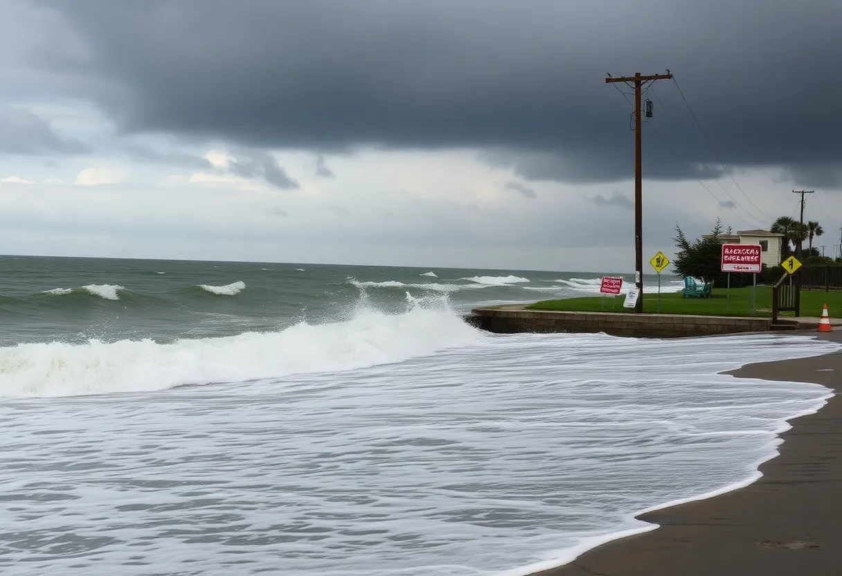
Coastal flooding and ocean overwash are expected to begin as early as August 19 and could persist for several days. Portions of North Carolina Highway 12 on Hatteras Island are anticipated to become impassable due to flooding. As the storm grows in size and strength, life-threatening surf and rip currents are also projected to impact the Outer Banks region.
Impacts from Hurricane Erin are expected to commence on Tuesday, peak on Wednesday into Thursday, and begin to diminish late in the week. Tropical storm warnings are currently in effect for the Turks and Caicos Islands and the Southeastern Bahamas due to Erin’s ongoing influence.
Additionally, residents in Puerto Rico are dealing with flash flooding, landslides, and urban flooding from the storm’s heavy rainfall. Over the weekend, Erin experienced rapid intensification with wind speeds increasing by 45 mph in just 12 hours. The National Weather Service has issued a high surf advisory for beach areas along the East Coast, predicting wave heights to reach between 12 to 20 feet.
As the storm remains off the coast, rip currents and rough surf continue to pose risks for swimmers along the U.S. Eastern Seaboard and Atlantic Canada. The likelihood of beach erosion and possible damage to beachfront properties increases due to the storm’s powerful effects. The National Weather Service has cautioned that the risk for high rip currents will persist throughout the week.
Erin marks the first hurricane of the 2025 season and is the fifth named storm overall. The National Oceanic and Atmospheric Administration has updated hurricane forecasts, expecting between 13 to 18 named storms and 5 to 9 hurricanes this season.
FAQ Section
What is the current status of Hurricane Erin?
Hurricane Erin has strengthened into a Category 4 storm with sustained winds of 130 mph.
Where is Hurricane Erin located?
The storm is about 110 miles northeast of Grand Turk Island and 935 miles south-southeast of Cape Hatteras, North Carolina.
What evacuation orders have been issued in North Carolina?
Dare County has declared a state of emergency and issued mandatory evacuations for Hatteras Island, starting Monday at 10 a.m., while Hyde County has ordered evacuations for visitors and residents to follow.
What impacts can be expected from Hurricane Erin?
Coastal flooding, ocean overwash, dangerous surf, and rip currents are anticipated along the North Carolina coastline, with potential impacts commencing Tuesday and peaking on Wednesday into Thursday.
Key Features of Hurricane Erin
| Feature | Details |
|---|---|
| Current Category | Category 4 |
| Sustained Winds | 130 mph |
| Peak Wind Speed | 160 mph (Category 5) |
| Location | 110 miles northeast of Grand Turk Island |
| Expected Impacts Start | Tuesday |
| Requested Evacuations | Hatteras Island and Hyde County |
| Forecast Wave Heights | 12 to 20 feet |
Deeper Dive: News & Info About This Topic
HERE Resources
Dare County Declares State of Emergency as Hurricane Erin Approaches
North Carolina’s Outer Banks Under Mandatory Evacuations as Hurricane Erin Approaches
North Carolina Prepares for Hurricane Erin’s Approach
Dare County Declares State of Emergency as Hurricane Erin Approaches
Hurricane Erin Downgraded to Category 3 Storm in Puerto Rico
Hurricane Erin Weakens to Category 3: Impact Spreads Across the Caribbean
Hurricane Erin Rapidly Intensifies to Category 5
Hurricane Erin Intensifies to Category 2 Near Leeward Islands
Hurricane Erin Threatens Oceanfront Homes in Rodanthe, NC
Tropical Storm Erin Expected to Strengthen into a Hurricane
Additional Resources
- ABC11 News
- CBS News
- USA Today
- The Weather Channel
- News Observer
- Wikipedia: Hurricane Season
- Google Search: Hurricane Erin
- Google Scholar: Hurricane Erin
- Encyclopedia Britannica: Hurricane Erin
- Google News: Hurricane Erin


