Outer Banks, North Carolina, October 9, 2025
News Summary
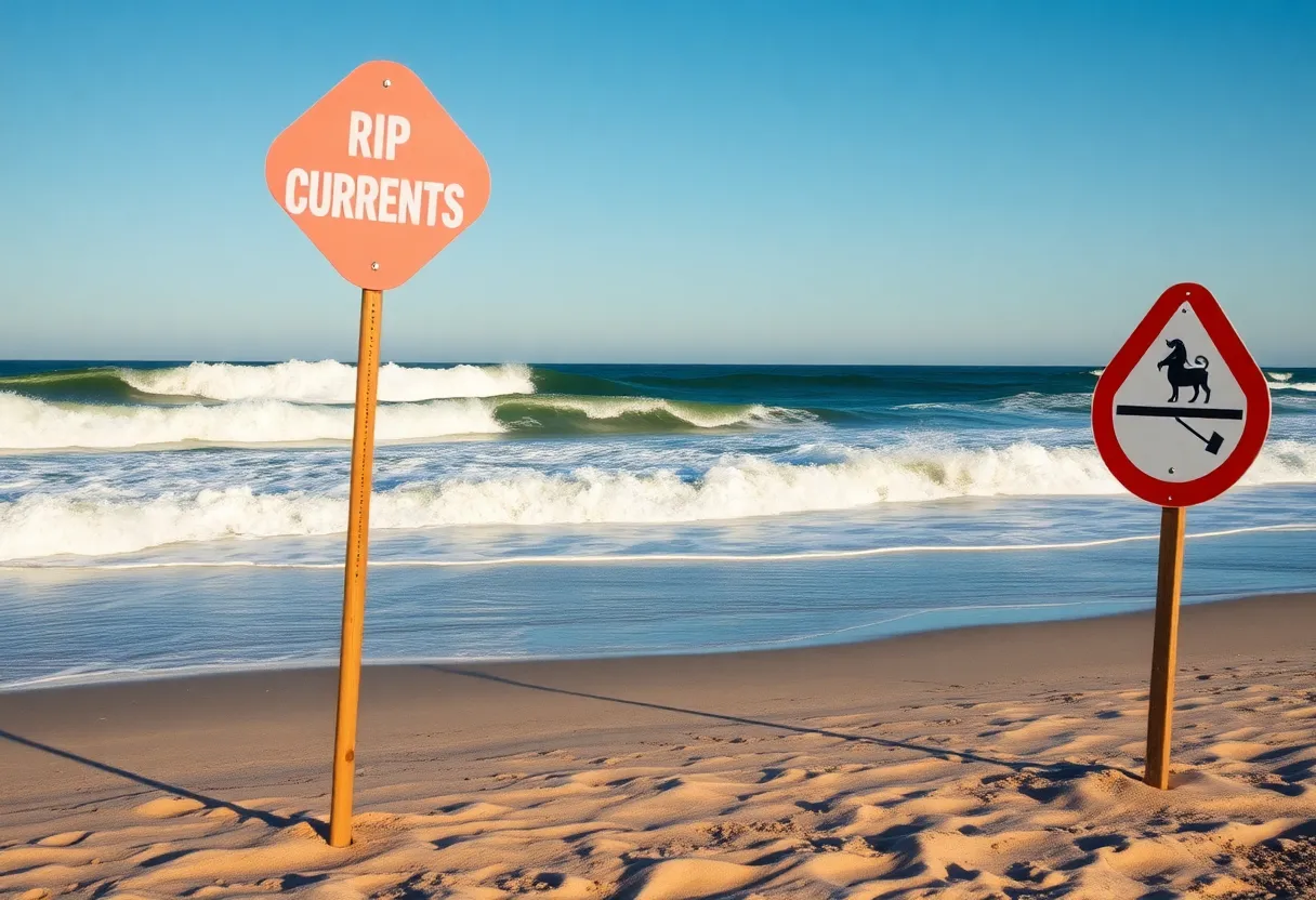
The National Weather Service has issued a beach hazards statement for the Northern Outer Banks due to dangerous rip currents and large waves. The warning is valid on Thursday from 8 a.m. to 8 p.m. Travelers should be cautious of road closures from flooding. Additionally, property owners in flood-prone areas are advised to protect their properties. This situation emphasizes the importance of safety measures regarding rip currents, as the region faces ongoing challenges from sea level rise and erosion.
Outer Banks, North Carolina – The National Weather Service (NWS) Newport/Morehead City NC has issued a beach hazards statement for the Northern Outer Banks due to dangerous rip currents and large breaking waves. The warning, issued on Wednesday at 8:26 p.m., is valid for Thursday from 8 a.m. to 8 p.m. This advisory is especially important as the NWS has emphasized that rip currents can pose life-threatening risks, potentially sweeping even experienced swimmers away from the shore.
Individuals planning to travel to affected areas are advised to allow extra time, as road closures may occur due to flooding. The NWS has urged drivers not to drive around barricades or through water of unknown depth. Additionally, property owners in flood-prone regions are recommended to take necessary actions to protect their properties amidst the hazardous conditions.
The NWS has outlined safety instructions in case one finds themselves caught in a rip current. People are advised to remain calm and to swim parallel to the shore. If tired, it is recommended to float or tread water until help arrives. Calling for assistance or waving for help is encouraged if unable to escape the current alone.
A previous updated beach hazards statement was also issued on Monday at 11:11 a.m., which remained in effect for East Carteret, Northern Outer Banks, Ocracoke Island, and Hatteras Island until 8 p.m. The NWS has indicated that the highest risk for dangerous rip currents will occur around low tide, expected around 1:30 p.m. on Thursday.
In recent developments, eight homes in North Carolina’s Outer Banks have collapsed due to the impacts of Hurricane Imelda, which passed 170 miles from the East Coast. This unfortunate incident marks the 20th home lost along the Outer Banks in the past five years. Coastal experts have attributed this increasing trend of property damage to a combination of rising sea levels, flooding, rip currents, and ongoing erosion impacting the shoreline.
Since 1987, the Outer Banks have lost approximately 675 feet of coastline. A 2023 study highlighted that Rodanthe is losing over 15 feet of coastline annually. These narrow barrier islands, predominantly made of sand, lack natural barriers such as rocky cliffs or mangroves, making them particularly vulnerable to erosion. Human-induced developments have further exacerbated this issue by interfering with natural sand movement and decreasing the vegetation that protects the coastline.
According to federal projections, the region’s sea level could rise by up to 14 inches by 2050, potentially increasing the days of coastal flooding tenfold. The change in the shoreline has been noted to accelerate over recent decades, strongly linked to sea level rise. This situation poses an ongoing challenge for residents and those who visit the Outer Banks, highlighting the need for awareness and preparedness regarding coastal hazards and environmental changes.
Frequently Asked Questions
What is the beach hazards statement issued for the Outer Banks?
The National Weather Service (NWS) Newport/Morehead City NC issued a beach hazards statement for the Northern Outer Banks due to dangerous rip currents and large breaking waves, valid for Thursday from 8 a.m. to 8 p.m.
What safety measures should one take if caught in a rip current?
If caught in a rip current, individuals are advised to remain calm, swim parallel to the shore, float or tread water if tired, and call or wave for help if unable to escape.
What impact is climate change having on the Outer Banks?
Coastal experts highlight the rising combination of sea levels, flooding, rip currents, and erosion as factors damaging the shoreline. The Outer Banks have lost approximately 675 feet of shoreline since 1987, with projections indicating sea levels could rise by 14 inches by 2050.
Key Features
| Feature | Details |
|---|---|
| Beach Hazards Statement Issued | Valid for Northern Outer Banks from 8 a.m. to 8 p.m. on Thursday. |
| Rip Current Risks | Life-threatening rip currents are expected, especially around low tide. |
| Recent Home Collapses | Eight homes collapsed due to Hurricane Imelda, marking 20 homes lost in five years. |
| Coastline Loss | The Outer Banks lost approximately 675 feet since 1987; Rodanthe loses over 15 feet annually. |
| Future Projections | Federal projections indicate a possible sea level rise of 14 inches by 2050. |
Deeper Dive: News & Info About This Topic
HERE Resources
Hurricane Erin Weakens: Recovery Begins in North Carolina
Southern Shores: Utah’s Premier Watersports Community
Nags Head Homes Devoured by Atlantic Waves
Coastal Flooding Threatens Southeast and Mid-Atlantic Regions
Severe Coastal Erosion Causes Home Collapses in Buxton, N.C.
North Carolina’s Outer Banks Faces Coastal Flooding Threat from King Tides
Tropical Storm Jerry Strengthens in the Atlantic
Nine Homes Collapsed in North Carolina’s Outer Banks Due to Hurricanes
Buxton, North Carolina Faces Catastrophic Home Collapses Due to Coastal Erosion
Dangerous Rip Currents Warning Issued for Outer Banks
Additional Resources
- Star News Online
- Wikipedia: Rip Current
- Charlotte Observer
- Google Search: Coastal Erosion
- WITN
- Google Scholar: Climate Change Impact on Coastal Regions
- News Observer
- Encyclopedia Britannica: Coastal Erosion
- 13 News Now
- Google News: Outer Banks Weather


