Outer Banks, NC, September 29, 2025
News Summary
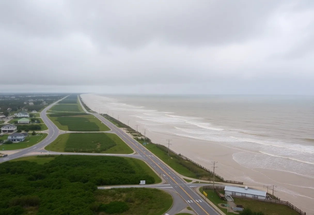
The National Weather Service has issued a coastal flood watch for the Northern Outer Banks, warning of potential flooding of up to 1 to 2 feet in low-lying areas. The watch is effective from Tuesday at 11 a.m. until Saturday at 8 a.m., with dangerous conditions expected, including strong rip currents and beach erosion. Residents are urged to prepare for possible evacuations and avoid flooded areas, as rain is forecasted to contribute to hazardous conditions.
Coastal Flood Watch Issued for Northern Outer Banks
The National Weather Service (NWS) Newport/Morehead City NC has issued a coastal flood watch for the Northern Outer Banks, effective from Tuesday at 11 a.m. until Saturday at 8 a.m. This alert comes as meteorological conditions suggest the possibility of minor coastal flooding in low-lying areas adjacent to shorelines and tidal waterways.
Residents and travelers in the affected zones should be aware that up to 1 to 2 feet of inundation above ground level is expected in vulnerable areas. Some roads and low-lying properties, including parking lots, parks, lawns, and homes, may experience minor flooding. Conditions are predicted to lead to dangerous swimming and surfing environments with a heightened risk of beach erosion.
Individuals should take precautionary measures, especially those planning to enter the water, as inexperienced swimmers face severe hazards posed by life-threatening rip currents. The most likely period for strong rip currents will occur around low tide, approximately 7 p.m. on Monday. In light of these dangers, the NWS urges travelers to allow extra time for their journeys, as certain roads could be closed due to floodwaters. Driving around barricades or through any unknown depths of water is strongly discouraged.
Those residing in flood-prone areas are advised to prepare for possible evacuations by moving to higher ground when necessary. If evacuation orders are issued, it is vital to act immediately, ensuring homes are locked and utilities are disconnected if time allows. Additional guidance includes avoiding basements or rooms with submerged electrical outlets or cords and evacuating if any sparks or unusual noises are detected.
Emergency officials warn that water could be charged with electricity, making it crucial to stay away from floodwaters. Floodwaters as shallow as 6 inches can easily knock a person off their feet, while 12 inches of fast-moving water has the potential to carry away most vehicles. Drivers are particularly cautioned about hydroplaning, which occurs when vehicles slide uncontrollably on wet roads due to water pressure building under tires.
The NWS emphasizes that heavy rain contributes significantly to flooding events, especially in low-lying regions. Residents are encouraged to stay tuned for ongoing updates regarding potential flooding, with the advisory having been issued at 4:06 a.m. on Monday and remaining in effect until Friday at 8 p.m.
Flood Preparedness Overview
- Coastal flood watch effective Tuesday at 11 a.m. to Saturday at 8 a.m.
- 1 to 2 feet of flooding above ground level expected in vulnerable zones.
- Hazards include strong rip currents and potential beach erosion.
- Inexperienced swimmers urged to stay out of the water.
- Residents in flood zones should prepare for potential evacuations.
- Avoid driving through flooded areas; hydroplaning risks are high.
Background Information
Coastal flood watches are issued when there is a potential for flooding that could lead to hazardous conditions. This particular watch is in response to predicted heavy rains and conditions conducive to flooding in low-lying areas. The NWS continuously monitors weather developments and posts advisories to keep the public informed about potential natural hazards.
FAQ
What is the duration of the coastal flood watch?
The watch is valid from Tuesday at 11 a.m. until Saturday at 8 a.m.
What areas are expected to experience flooding?
Minor coastal flooding is possible in low-lying areas near shorelines and tidal waterways.
When is the most likely time for strong rip currents?
The most likely time for strong rip currents is around low tide, occurring at approximately 7 p.m. on Monday.
What precautions should residents take?
Residents in flood-prone areas should prepare by moving to higher ground if necessary and evacuating if advised.
What should drivers be aware of during this time?
Drivers are urged to allow extra time as some roads may be closed due to flooding. It’s advised to avoid driving around barricades or through unknown depths of water.
Key Features Overview
| Feature | Details |
|---|---|
| Watch Duration | Tuesday 11 a.m. – Saturday 8 a.m. |
| Expected Inundation | 1 to 2 feet in vulnerable areas |
| Rip Current Timing | Around low tide at 7 p.m. on Monday |
| Driver Advisory | Avoid flooded roads and driving around barricades |
| Evacuation Guidance | Move to higher ground and evacuate if necessary |
Deeper Dive: News & Info About This Topic
HERE Resources
Tropical Storm Imelda Approaching North Carolina Coast
High Surf Advisory Issued for Outer Banks Amid Hurricane Erin
Coastal Flood Advisory for Northern Outer Banks Amid Hurricane Erin
Hazardous Beach Conditions Alert for Outer Banks
Hurricane Humberto Intensifies to Category 5 Threatening U.S. East Coast
Two Tropical Systems Threaten the East Coast
House Collapse in Buxton Highlights Coastal Erosion Crisis
Beachfront Home in Buxton Collapses into Atlantic Ocean
Coastal Erosion Claims Another Home in Buxton
Hampton Roads Weekend Events Highlight Entertainment and Culture
Additional Resources
- Charlotte Observer
- Wikipedia: Hurricane Erin
- Herald Sun
- Google Search: Hurricane Erin updates
- News Observer
- Encyclopedia Britannica: Flood
- Fox Weather
- Google News: Hurricane Erin
- CBS 17
- Google Scholar: Hurricane Erin
- BBC News


