Nags Head, North Carolina, September 29, 2025
News Summary
The National Weather Service has issued a High Surf Advisory for the Outer Banks as Hurricane Erin approaches, bringing dangerous surf and strong winds. Residents are advised to prepare for high waves, potential flooding, and hazardous beach conditions expected to impact the area until Saturday morning. Evacuation orders are already in place for several beaches as dangerous rip currents and erosion are anticipated. Safety precautions are strongly recommended as storm conditions are forecasted to worsen.
Nags Head, North Carolina — The National Weather Service (NWS) Newport/Morehead City NC has issued a High Surf Advisory effective from 5 p.m. Monday until Saturday at 8 a.m. This advisory comes as Hurricane Erin, currently a Category 2 storm well offshore, approaches the region, anticipating severe weather conditions that will significantly impact the Northern Outer Banks.
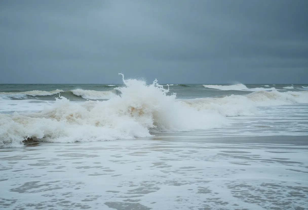
Residents and visitors should brace for large breaking waves, expected to range from 6 to 8 feet, building up to 10 to 12 feet. Strong rip currents will also pose significant risks, particularly around low tide, which occurs at approximately 7 p.m. Monday. Minor flooding of 1 to 2 feet above ground level may affect low-lying areas close to shorelines and tidal waterways, with a low threat of property damage expected near waterfronts, including in roads, parks, and parking lots.
The conditions at sea will make swimming and surfing extremely dangerous, with the potential for severe beach erosion. Experiencing rip currents could be life-threatening, even for seasoned swimmers. Evacuation orders have already been put in place for several North Carolina beaches as a precautionary measure against Hurricane Erin’s anticipated effects.
Although Hurricane Erin is still well offshore, tropical storm conditions are forecasted to start impacting the Outer Banks late Wednesday. Tropical Storm and Storm Surge Warnings are currently in effect. Forecasts predict extreme beach and coastal damage from strong winds and high waves that the hurricane will generate. In particular, a storm surge inundation of 2 to 4 feet is expected along the coastal areas.
Reports indicate that areas under a High Surf Advisory could see breaking waves reaching between 15 and 20 feet. With extreme beach erosion and potential overwash conditions, certain roads may become impassable for several days. Dare County has declared a state of emergency in response to the impending threat posed by Hurricane Erin.
Conditions are expected to peak from Wednesday into Thursday, and residents and visitors are being advised to take necessary precautions to safeguard flood-prone properties. Anticipated winds could reach up to 60 mph, primarily affecting Nags Head, Kitty Hawk, and Hatteras Island.
The public is being urged to be extra cautious, especially concerning local road closures and shallow flooding situations. Authorities strongly recommend against driving around barricades or through unfamiliar water depths. Notably, numerous water rescues have already been conducted in North Carolina due to the hazardous surf conditions, highlighting the urgency of the situation.
If individuals find themselves caught in a rip current, they should swim parallel to the shore, float or tread water if feeling fatigued, and signal for help if unable to escape from the current.
Key Details:
- High Surf Advisory: Effective from 5 p.m. Monday until Saturday at 8 a.m.
- Waves: Expected to reach 10 to 12 feet.
- Rip Currents: Likely exposure around low tide.
- Flooding: Minor inundation of 1 to 2 feet expected in low-lying areas.
- Wind Speeds: Up to 60 mph in certain areas.
- Storm Surge: 2 to 4 feet predicted along oceanside.
- Evacuations: Orders issued for several beaches in North Carolina.
FAQ
What is the duration of the High Surf Advisory?
The High Surf Advisory is effective from 5 p.m. Monday until Saturday at 8 a.m.
What wave heights can we expect during the advisory?
Large breaking waves of 6 to 8 feet are expected, building up to 10 to 12 feet.
What are the expected wind speeds as Hurricane Erin approaches?
Winds up to 60 mph could affect Nags Head, Kitty Hawk, and Hatteras Island.
What safety precautions should be taken?
Residents and visitors should take precautions to protect flood-prone properties and avoid swimming in dangerous conditions.
Key Features of the Advisory:
| Feature | Description |
|---|---|
| Duration | 5 p.m. Monday until Saturday at 8 a.m. |
| Expected Waves | 6 to 12 feet |
| Wind Speed | Up to 60 mph |
| Flood Inundation | 1 to 2 feet in low-lying areas |
| Evacuations | Issued for several beaches |
Deeper Dive: News & Info About This Topic
HERE Resources
Coastal Flood Advisory for Northern Outer Banks Amid Hurricane Erin
Hazardous Beach Conditions Alert for Outer Banks
SimpleSide Construction Takes Lead in Coastal Deck Building
Filming of ‘Outer Banks’ Halted Again by Weather
Hurricane Humberto Intensifies to Category 5 Threatening U.S. East Coast
Beachfront Home in Buxton Collapses into Atlantic Ocean
Coastal Erosion Claims Another Home in Buxton
Hampton Roads Weekend Events Highlight Entertainment and Culture
Mid-Currituck Bridge Project Advances with Key Permits
Coastal Storm Causes Severe Flooding in Virginia Beach
Additional Resources
- News Observer
- Wikipedia: Hurricane Erin
- CBS 17
- Google Search: Hurricane Erin
- Fox Weather
- Encyclopedia Britannica: Hurricane Erin
- WXII 12
- Google News: Hurricane Erin


