Outer Banks, North Carolina, August 19, 2025
News Summary
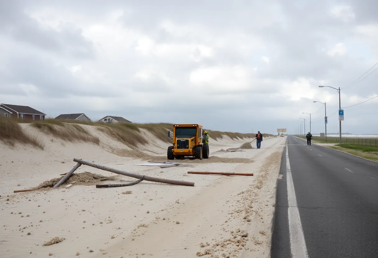
Hurricane Erin has prompted mandatory evacuations across North Carolina’s Outer Banks, including Hatteras Island, as powerful winds and waves threaten residents and tourists. Local businesses are scrambling to prepare, and emergency officials are urging everyone to prioritize safety as significant coastal flooding is expected. The storm, which has weakened but is still dangerous, has raised concerns about life-threatening conditions, especially for those with medical needs.
Hatteras Island, North Carolina
Hurricane Erin has triggered mandatory evacuations in North Carolina’s Outer Banks as dangerous waves and wind threaten the region. Evacuations were ordered for barrier islands, including Hatteras Island, due to risks posed by rip currents and projected wave heights reaching up to 15 feet (4.6 meters).
As Hurricane Erin approached, local business owner Holly Andrzejewski faced the daunting task of rescheduling guests at her newly acquired bed-and-breakfast, the Atlantic Inn. Andrzejewski and her husband purchased the inn less than a week before the hurricane, finding themselves in a race to prepare for the impending storm.
The hurricane, which had earlier lashed the Caribbean with strong winds and heavy rain, was located approximately 685 miles (1,105 kilometers) southwest of Bermuda and was moving northwest at a speed of 7 mph (11 kph). Forecasters anticipated the storm would generally remain offshore, yet tropical storm and surge watches were issued for much of the Outer Banks area, with significant coastal flooding expected from Tuesday through Thursday.
Evacuation Orders and Safety Measures
Evacuation orders affected tourists and residents in the region at the height of the tourist season. Hatteras and nearby Ocracoke Island were placed under mandatory evacuation for the first time since Hurricane Dorian in 2019. Emergency officials warned that local roads could become impassable due to flooding.
In preparation for the storm, Andrzejewski worked to secure outdoor furniture and stock essential items such as generators and extra supplies for her daughter and son-in-law, who manage the inn. Local grocery store owners expressed hope that Hurricane Erin would not be as destructive as previous storms, while officials emphasized the importance of evacuating those with medical needs as emergency services could be disrupted by flooding.
Current Status of Hurricane Erin
As of early Tuesday, Hurricane Erin had weakened from its previous strength, with maximum sustained winds recorded at 120 mph (195 kph). The storm had fluctuated in strength, having reached Category 5 at one point before stabilizing at Category 4 or 3. The National Weather Service warned of hazardous conditions anticipated along the East Coast, with significant rip current risks extending to Canada’s Atlantic coast.
Reports indicated that Wrightsville Beach officials had already rescued at least 60 swimmers caught in dangerous rip currents. It was also noted that up to 8 inches of snowfall could occur in parts of the Southeastern Bahamas, with warnings of flash flooding issued for that area.
Climate Change and Hurricane Risks
Scientists are drawing connections between more rapid hurricane intensification and climate change, citing warmer ocean waters as a catalyst for stronger storms. The most severe threat from Hurricane Erin was expected for Bermuda by Thursday evening, where wave heights could reach up to 24 feet (7 meters).
Emergency officials urged residents to avoid entering dangerous waters, cautioning that conditions could lead to life-threatening situations. As the storm progresses, emergency systems throughout North Carolina may become compromised, underlining the need for prompt evacuations from the affected areas.
Key Impacts and Observations
- Coastal flooding is expected to disrupt local highways and could cause structural damage.
- States of emergency have been declared in Dare County in preparation for Hurricane Erin’s impact.
- Evacuations were trending well ahead of the storm’s landfall to ensure the safety of visitors and residents alike.
Conclusion
The developments surrounding Hurricane Erin highlight the critical importance of preparedness in coastal communities facing such natural threats. As residents and tourists evacuate in anticipation of the storm, local officials continue to monitor the hurricane’s progress and implement safety measures.
FAQ
- What areas are under evacuation orders?
- Mandatory evacuation orders have been issued for Hatteras and Ocracoke Islands.
- How strong is Hurricane Erin currently?
- Hurricane Erin has maximum sustained winds of 120 mph (195 kph) and has been fluctuating in strength.
- Why are evacuations being held now?
- Evacuations are taking place to ensure the safety of residents and visitors ahead of projected severe coastal flooding and dangerous conditions.
- What impacts are expected from the storm?
- Expected impacts include significant coastal flooding, disruptions to highways, and possible structural damage.
- What towns are most affected by Hurricane Erin?
- Towns in North Carolina’s Outer Banks, particularly Hatteras Island and Ocracoke Island, are most affected.
Chart of Key Features of Hurricane Erin
| Feature | Detail |
|---|---|
| Location | 685 miles southwest of Bermuda |
| Sustained Winds | 120 mph (195 kph) |
| Wave Height | Up to 15 feet (4.6 meters) |
| Evacuation Areas | Hatteras Island, Ocracoke Island |
| Hazardous Conditions | Coastal flooding, rip currents, potential structural damage |
Deeper Dive: News & Info About This Topic
HERE Resources
Outer Banks, North Carolina Braces for Hurricane Erin
Hurricane Erin Triggers Evacuations and Warnings Along U.S. East Coast
Hurricane Erin Strengthens as It Approaches Outer Banks, NC
Hurricane Erin Forces Evacuations in Hatteras, NC
Hurricane Erin Weakens, Still Threatens East Coast
Hurricane Erin Strengthens to Category 4: North Carolina Prepares for Impact
Dare County Declares State of Emergency as Hurricane Erin Approaches
North Carolina’s Outer Banks Under Mandatory Evacuations as Hurricane Erin Approaches
North Carolina Prepares for Hurricane Erin’s Approach
Dare County Declares State of Emergency as Hurricane Erin Approaches
Additional Resources
- Axios: Hurricane Erin Updates
- Wikipedia: Hurricane Erin
- USA Today: Hurricane Erin Updates
- Google Search: Hurricane Erin
- Washington Post: Hurricane Erin Path
- Google Scholar: Hurricane Erin
- WBTV: Evacuation Orders for Hurricane Erin
- Encyclopedia Britannica: Hurricane Erin
- Pilot Online: Hatteras Evacuation
- Google News: Hurricane Erin North Carolina


